REDS / UTAH LAND & DEVELOPMENT

What could your land become?

Development potential starts with facts about a specific property. Use this checklist to organize the first conversation and identify the questions that need confirmation with the relevant city, county, providers and qualified advisers.

Talk about your property ↗

01

Identify the property and the decision

Start with the address or parcel reference, approximate size, ownership information and any existing plans or agreements. Describe what you want to understand: a possible sale, a different use, subdivision or participation in a development.

02

Confirm the current land-use picture

Ask the relevant planning office about current zoning, applicable plans and the process for the use you have in mind. Keep existing approvals separate from a concept that would require new approval. Do not assume a nearby project establishes what your parcel can do.

03

Understand access and services

Identify existing road access and what still needs to be confirmed about its suitability. Ask the relevant providers about water, sewer and other utilities, available service information and the process for evaluating an extension or upgrade.

04

Identify physical and recorded constraints

Gather available surveys, topographic information, recorded easements and known site concerns. Identify which questions require a title professional, surveyor, engineer or other specialist. Missing information should remain an open question, not become an assumption.

05

Define the next investigation

Agree on the next question to resolve, who will resolve it and what information is needed. A preliminary discussion should lead to a specific investigation before a detailed concept or commitment.

This guide organizes an initial conversation. Property-specific conclusions require verification of current records, conditions and applicable requirements.

Talk about your property ↗
PRACTICAL STARTING POINTS

Before the next land decision.

LET’S TALK ABOUT THE NEXT STEP

Start a conversation

Choose the conversation that fits.

Prepare an email, then review and send it from your email app. Nothing is submitted here.

Your entries stay in this page when you switch paths.

Nothing is submitted on this website. Review and send the draft from your email app.

TY BRIGGS / UTAH DEVELOPMENT EXPERIENCE

Work with a record.

Start with a project story. Open the original plans when you want the detail.

Browse all 38 plats and 53 sheets
More project evidence and the complete portfolio

SELECTED DEVELOPMENT EXPERIENCE

Real communities.
Original project records.

Explore the full portfolio
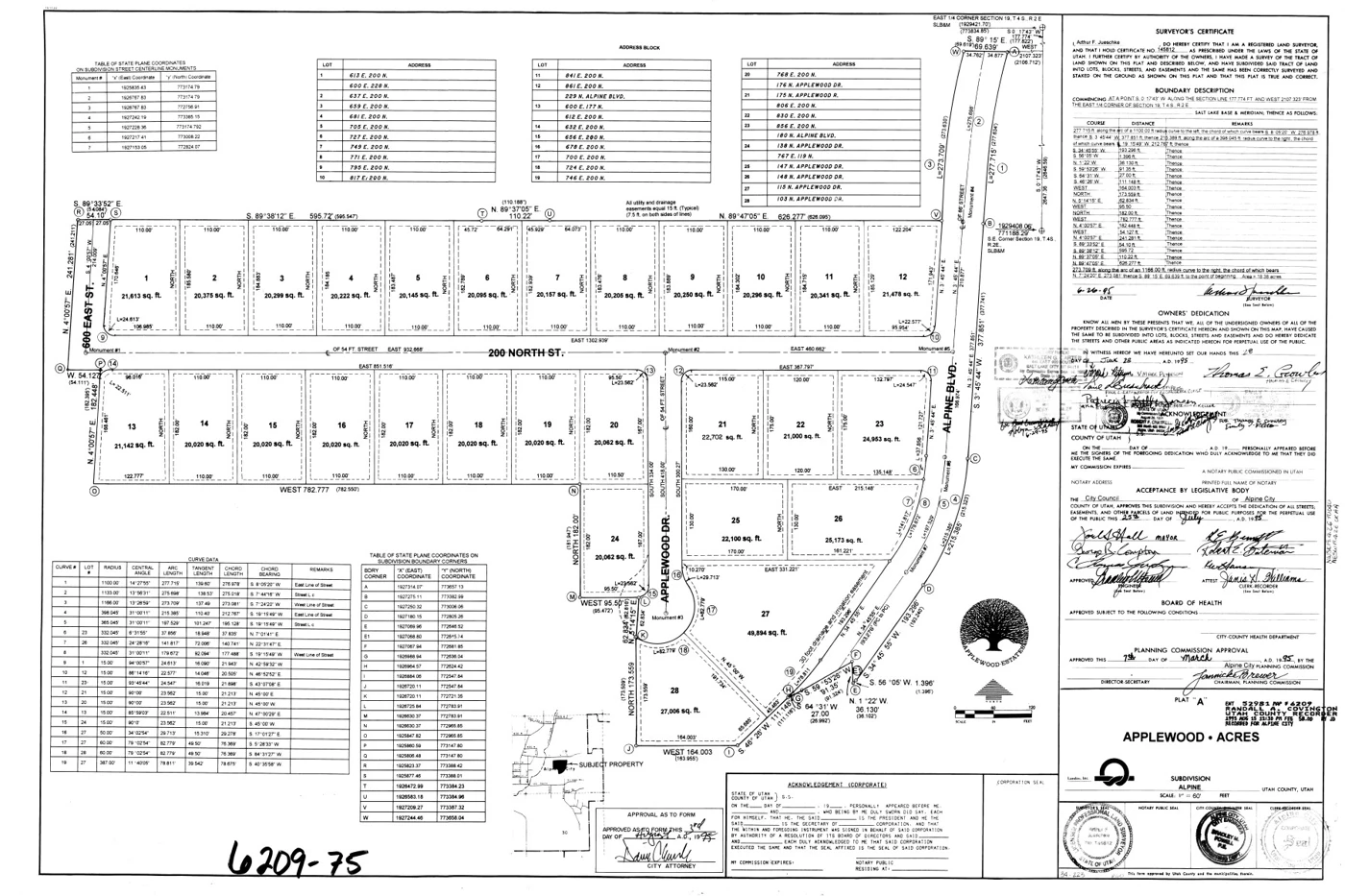
ORIGINAL PLAT / APPLEWOOD A

ALPINE, UTAH

Applewood

Multiple owners. A coordinated plan.

Ty coordinated land assembly across multiple owners, secured approvals and structured the residential development in Alpine.

3 original platsExplore Applewood
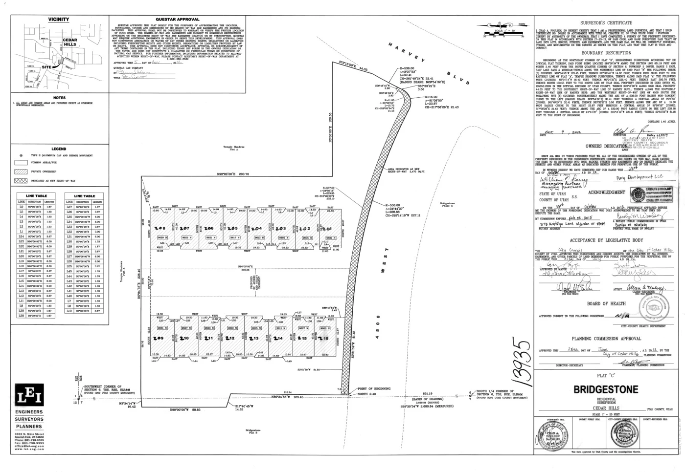
ORIGINAL PLAT / BRIDGESTONE C

PLEASANT GROVE BOUNDARY

Bridgestone

More housing. A familiar streetscape.

Ty’s portfolio includes four-plexes designed with the appearance of large single-family homes, underground parking and secure elevator access.

8 original platsExplore Bridgestone

THE COMPLETE PROJECT RECORD

Explore the portfolio.

More experience: Caddie Lane, Highland

A residential neighborhood planned within the golf-course setting alongside Alpine Country Club.

THE ORIGINAL PROJECT RECORD

Explore all 38 plats.

38 distinct plats. 53 original sheets.
Select a drawing, step through the sheets, or open its source PDF.

Browse the original sheets

PLAT 1 OF 38 / SHEET 1 OF 53

The Cedars Plat A / Sheet 1

Residential and townhome phases within the Cedars collection. Review how streets, lots and phase boundaries connect.

View plat Original PDF
30+

Years of Utah
development experience

38

Original plats
in the portfolio

1,000+

Residential units across
Ty’s development portfolio

THE COMMUNITY IN CONTEXT

The plans have a setting.

Briggs Boulevard at Canyon Road.

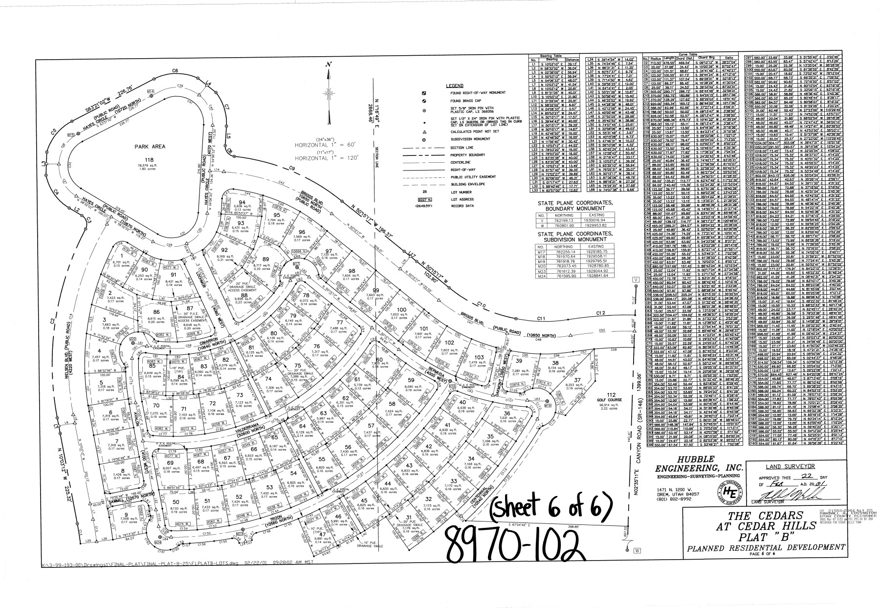
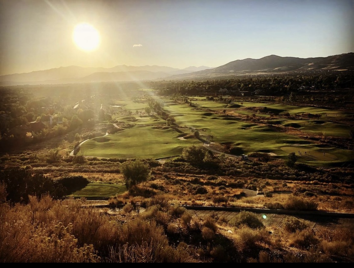
Curving residential streets, homes, park space and golf fairways appear together in the neighborhood view. The street sign adds a ground-level detail: Briggs Boulevard at Canyon Road.

Hayes Circle, the park and Briggs Boulevard connect the original Plat B drawing to the community photograph. The original plats provide the detailed project record.

Explore the original plats

FROM PAPER PLAT TO FINISHED COMMUNITY

See the whole project.
Understand the next step.

Land. Approvals. Infrastructure. Homes.
Each stage has to support the next.

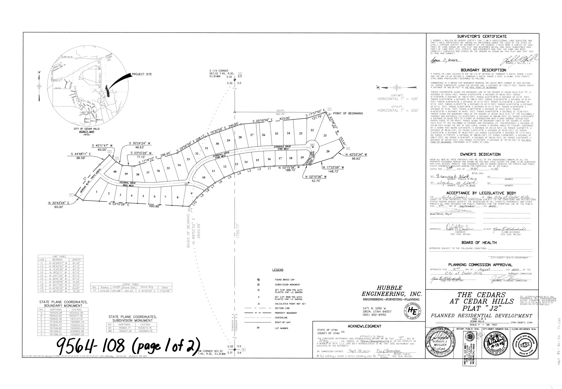
Plat J2 is an original project drawing. The other panels illustrate development stages.

TY BRIGGS / THE EXPERIENCE BEHIND REDS

See the land.
Work through the terms.
Keep the community in view.

Price is one part of the decision. Control, approvals, access and infrastructure determine what needs to happen next.

Ty’s experience spans land assembly in Alpine, coordinated annexation in Cedar Hills and Highland, golf-course development and zoning work for attainable housing. His experience also extends to bank branches and assisted living.

“The right people making the right decisions make houses into homes.”TY BRIGGS

Ty Briggs / Resume

Download Word

REDS / CLOSER LOOK

Project detail

Explore our work

Explore our work